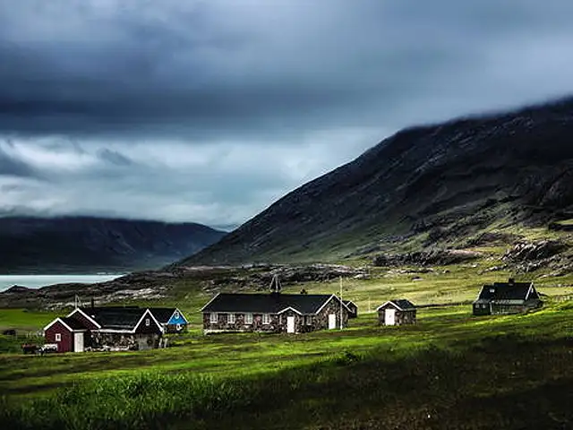
Bengaluru's residential area Rajajinagar was initially planned as an industrial suburb
Around 1,000 acres of land given for locality was divided into industrial and housing areas.
By Divya Shekhar, ET Bureau |

Agencies
Rajajinagar
A few months after he built the Ashoka Pillar in Jayanagar, PS Ranganatha Char was entrusted with another challenge. The contractor was asked by the City Improvement Trust Board (CITB) to build a similar pillar in west Bengaluru within 15 days.
After the task was successfully completed, the CITB (today’s Bangalore Development Authority or BDA) sent Char and his colleagues a certificate of appreciation for the “splendid work done by them in constructing the inaugural pillar in the industrial suburb in a very short time despite the weather conditions.” The certificate, dated July 4, 1949, was issued a day after the maharaja of Mysore Jayachamaraja Wadiyar, inaugurated Rajajinagar.
Named after statesman C Rajagopalachari, a plaque in the Rajajinagar pillar indicates that 1,000 acres of land given for the locality was divided into industrial and housing areas. The former comprised of 140 acres for textiles, 220 acres for machinery, 100 acres for chemical plants and 40 acres for the food sector. About 4,000 housing plots were created in the remaining 500 acres. Rajajinagar was built at an estimated cost of Rs 50 lakh.

Essentially the Oscars for sites that are naturally beautiful or culturally significant, the UNESCO World Heritage List is revaluated every year.
This week, the World Heritage Committee made 21 new choices during a meeting in Krakow, Poland.
The World Heritage Committee decided which of 33 nominated sites were worthy of being named the World Heritage Sites.
Eventually, 20 new places were added to the list, including the City of Yazd in Iran and Lake District in the UK.
Among the few constituencies in Bengaluru popular for the gender parity of its electorate (there are 963 women per 1,000 men), Rajajinagar was also known for is good water supply. “It was among the first stops for water that was pumped from the TG Halli reservoir. We even had four lakes here, which, over the years, have dried up or been encroached,” said Udaya Kumar PL of Inscription Stones of Bangalore.
The Rajajinagar resident said that his locality came up near villages that may have predated Bengaluru. “I discovered an inscription stone near Rajajinagar that narrated the history of a neighbouring village called Kethmaranahalli. It was created around 1300 AD, a full two centuries before Kempegowda laid the foundation of modern Bengaluru in 1537.”
Interestingly, while Jayanagar (named after maharaja Jayachamaraja Wadiyar) was inaugurated by C Rajagopalachari, Rajajinagar was inaugurated by the Mysore maharaja. PR Ramaswamy, contractor Char’s septuagenarian son, said that the pillar that defined Rajajinagar had pedestals of dressed granite stones. “The stone dressing and polishing could not be carried on site, so the stones were numbered and transferred to the Satyanarayana Temple at Visveswarapuram (VV Puram). This was carried out in a record time of two days,” he said.
Despite being a planned locality, the Rajajinagar of today suffers from acute water shortages and traffic congestion due to ongoing projects like the eight-lane corridor at Okalipuram. Artist Bakula Nayak, who spent her childhood here, said that the locality that was defined by its “matchbox-sized stores”, art deco buildings and strong sense of community bonding has changed. “It is losing out on its charm to resemble any other gentrified locality of the city.”
A few months after he built the Ashoka Pillar in Jayanagar, PS Ranganatha Char was entrusted with another challenge. The contractor was asked by the City Improvement Trust Board (CITB) to build a similar pillar in west Bengaluru within 15 days.
After the task was successfully completed, the CITB (today’s Bangalore Development Authority or BDA) sent Char and his colleagues a certificate of appreciation for the “splendid work done by them in constructing the inaugural pillar in the industrial suburb in a very short time despite the weather conditions.” The certificate, dated July 4, 1949, was issued a day after the maharaja of Mysore Jayachamaraja Wadiyar, inaugurated Rajajinagar.
Named after statesman C Rajagopalachari, a plaque in the Rajajinagar pillar indicates that 1,000 acres of land given for the locality was divided into industrial and housing areas. The former comprised of 140 acres for textiles, 220 acres for machinery, 100 acres for chemical plants and 40 acres for the food sector. About 4,000 housing plots were created in the remaining 500 acres. Rajajinagar was built at an estimated cost of Rs 50 lakh.
This week, the World Heritage Committee made 21 new choices during a meeting in Krakow, Poland.
The World Heritage Committee decided which of 33 nominated sites were worthy of being named the World Heritage Sites.
Eventually, 20 new places were added to the list, including the City of Yazd in Iran and Lake District in the UK.


Among the few constituencies in Bengaluru popular for the gender parity of its electorate (there are 963 women per 1,000 men), Rajajinagar was also known for is good water supply. “It was among the first stops for water that was pumped from the TG Halli reservoir. We even had four lakes here, which, over the years, have dried up or been encroached,” said Udaya Kumar PL of Inscription Stones of Bangalore.
The Rajajinagar resident said that his locality came up near villages that may have predated Bengaluru. “I discovered an inscription stone near Rajajinagar that narrated the history of a neighbouring village called Kethmaranahalli. It was created around 1300 AD, a full two centuries before Kempegowda laid the foundation of modern Bengaluru in 1537.”
ADVERTISEMENT
Interestingly, while Jayanagar (named after maharaja Jayachamaraja Wadiyar) was inaugurated by C Rajagopalachari, Rajajinagar was inaugurated by the Mysore maharaja. PR Ramaswamy, contractor Char’s septuagenarian son, said that the pillar that defined Rajajinagar had pedestals of dressed granite stones. “The stone dressing and polishing could not be carried on site, so the stones were numbered and transferred to the Satyanarayana Temple at Visveswarapuram (VV Puram). This was carried out in a record time of two days,” he said.
Despite being a planned locality, the Rajajinagar of today suffers from acute water shortages and traffic congestion due to ongoing projects like the eight-lane corridor at Okalipuram. Artist Bakula Nayak, who spent her childhood here, said that the locality that was defined by its “matchbox-sized stores”, art deco buildings and strong sense of community bonding has changed. “It is losing out on its charm to resemble any other gentrified locality of the city.”
Download
The Economic Times Business News App for the Latest News in Business, Sensex, Stock Market Updates & More.
The Economic Times Business News App for the Latest News in Business, Sensex, Stock Market Updates & More.
ADVERTISEMENT

