Monsoon races to Kashmir from Kanyakumari: Equatorial system of clouds & conditions in Indian Ocean may back plentiful rains
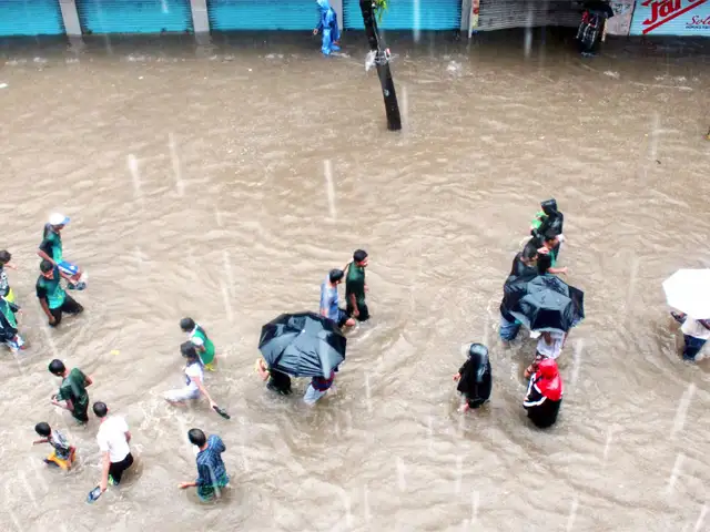
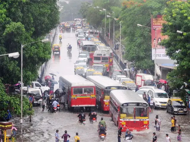
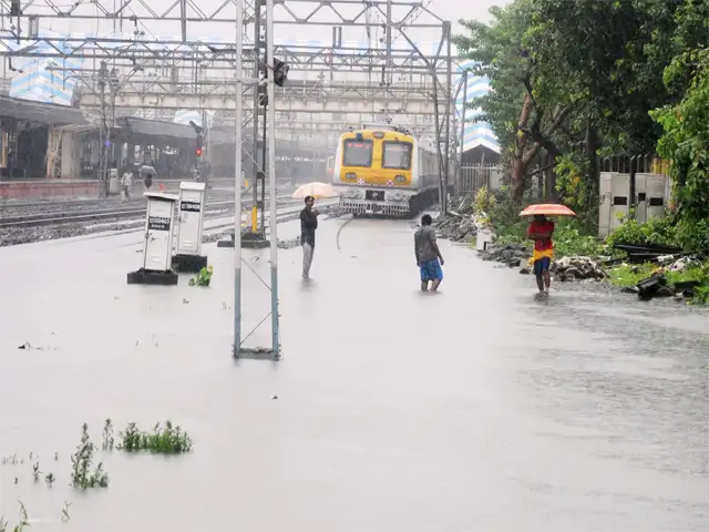
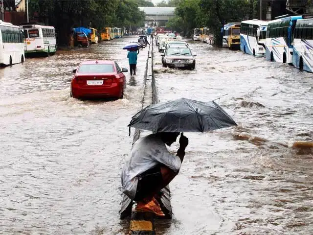
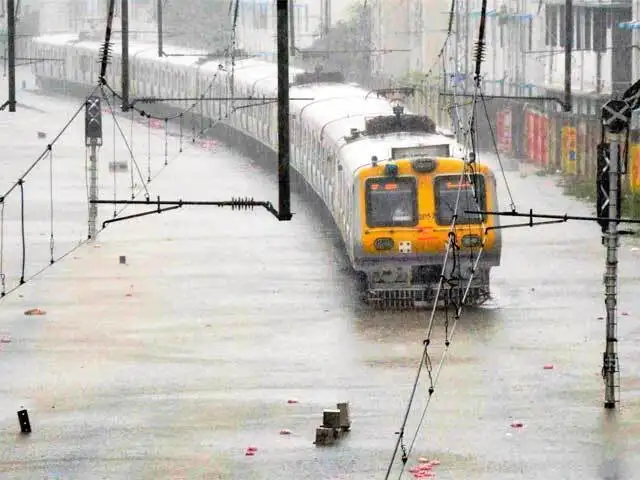
Monsoon has already delivered 16% excess rainfall since the start of the season on June 1, and is expected to remain strong at least until the end of the month.

NEW DELHI: Global climatic conditions have turbocharged the monsoon and given it the momentum to take it up to Kashmir in three to four days, a week ahead of schedule, and accelerate agricultural activity in the grain-bowl states of Punjab and Haryana on the say.
Rainfall in June is almost certain to be significantly more than normal, going by predictions of weather scientists from Australia to the US, giving a flying start to the four-month season that brings 75 per cent of the rainfall the country receives and fills up water reservoirs for irrigation and hydropower generation for a year.
The monsoon has already delivered 16 per cent excess rainfall since the start of the season on June 1, and is expected to remain strong at least until the end of the month. This should cheer the markets and calm fears of inflation, which had emerged as the monsoon made a sloppy start.
 The floundering monsoon has been catalysed by an equatorial system of clouds and disturbances that traverses the globe. The system, called Madden Julian Oscillation (MJO), has strengthened rain-bearing clouds along its path and given the country 33 per cent surplus rain on Saturday and a drenching 88 per cent surplus on Sunday. "MJO is definitely influencing the southwest monsoon," said Laxman Singh Rathore, director-general of meteorology, India Meteorological Department.
The phenomenon has countered the expected negative fallout of El Nino, which disrupts rainfall in Asia and floods other continents due to a rise in the surface temperature in the Pacific Ocean. Unlike El Nino that lingers for a long time, MJO is a transient phenomenon. DS Pai, IMD’s head of long-range forecasting, said MJO would weaken in the coming days and may return after some time. He said it typically recurs every 30-60 days.
The Climate Prediction Center in the US expects the phenomenon to strengthen the monsoon. "Dynamical models and MJO composites favour an enhancement of the South Asian Monsoon," it said in its forecast for the period up to June 23. For the following week, it said, "dynamical models support a continuation of enhanced South Asian Monsoon activity, excluding southern India". The Australian weather office also noted the impact of the MJO phenomenon. "MJO may also act to enhance South Asia Monsoon as it moves across the region," it said earlier this week.
Making good progress
In its current phase, the monsoon is making good progress. "Conditions are favourable for further advance of southwest monsoon into remaining parts of north Arabian sea, Gujarat state, Chhattisgarh, Jharkhand, entire Bihar, Uttarakhand, Himachal Pradesh, Jammu & Kashmir, most parts of Madhya Pradesh and some parts of Uttar Pradesh, Punjab, Haryana, Chandigarh and Delhi and Rajasthan during the next 3-4 days," the weather office says.
Meteorologists at the weather office also said the neutral Indian Ocean Dipole (IOD) — a term that refers to differences in surface temperature in different parts of the Indian Ocean — was also strengthening the monsoon. "Parameters are quite close to being positive which generally makes for a good monsoon," said a meteorologist. IOD is an irregular oscillation of sea surface temperatures in which the western Indian Ocean becomes alternately warmer and then colder than the eastern part of the ocean. The monsoon season had given early jitters as rainfall was weak and crop planting lagged about 10 per cent behind last year.
Rainfall in June is almost certain to be significantly more than normal, going by predictions of weather scientists from Australia to the US, giving a flying start to the four-month season that brings 75 per cent of the rainfall the country receives and fills up water reservoirs for irrigation and hydropower generation for a year.
The monsoon has already delivered 16 per cent excess rainfall since the start of the season on June 1, and is expected to remain strong at least until the end of the month. This should cheer the markets and calm fears of inflation, which had emerged as the monsoon made a sloppy start.
The phenomenon has countered the expected negative fallout of El Nino, which disrupts rainfall in Asia and floods other continents due to a rise in the surface temperature in the Pacific Ocean. Unlike El Nino that lingers for a long time, MJO is a transient phenomenon. DS Pai, IMD’s head of long-range forecasting, said MJO would weaken in the coming days and may return after some time. He said it typically recurs every 30-60 days.
The Climate Prediction Center in the US expects the phenomenon to strengthen the monsoon. "Dynamical models and MJO composites favour an enhancement of the South Asian Monsoon," it said in its forecast for the period up to June 23. For the following week, it said, "dynamical models support a continuation of enhanced South Asian Monsoon activity, excluding southern India". The Australian weather office also noted the impact of the MJO phenomenon. "MJO may also act to enhance South Asia Monsoon as it moves across the region," it said earlier this week.
ADVERTISEMENT
Making good progress
In its current phase, the monsoon is making good progress. "Conditions are favourable for further advance of southwest monsoon into remaining parts of north Arabian sea, Gujarat state, Chhattisgarh, Jharkhand, entire Bihar, Uttarakhand, Himachal Pradesh, Jammu & Kashmir, most parts of Madhya Pradesh and some parts of Uttar Pradesh, Punjab, Haryana, Chandigarh and Delhi and Rajasthan during the next 3-4 days," the weather office says.
Meteorologists at the weather office also said the neutral Indian Ocean Dipole (IOD) — a term that refers to differences in surface temperature in different parts of the Indian Ocean — was also strengthening the monsoon. "Parameters are quite close to being positive which generally makes for a good monsoon," said a meteorologist. IOD is an irregular oscillation of sea surface temperatures in which the western Indian Ocean becomes alternately warmer and then colder than the eastern part of the ocean. The monsoon season had given early jitters as rainfall was weak and crop planting lagged about 10 per cent behind last year.
Download
The Economic Times Business News App for the Latest News in Business, Sensex, Stock Market Updates & More.
The Economic Times Business News App for the Latest News in Business, Sensex, Stock Market Updates & More.
Download
The Economic Times News App for Quarterly Results, Latest News in ITR, Business, Share Market, Live Sensex News & More.
The Economic Times News App for Quarterly Results, Latest News in ITR, Business, Share Market, Live Sensex News & More.
Related Articles
 Indian ocean an 'ocean of opportunity': Modi
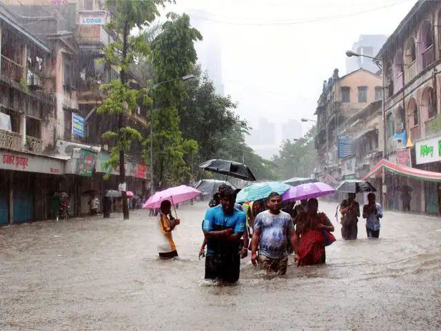


ADVERTISEMENT

