US weather updates: ‘Powerful’ storm expected to hit California in the coming days; Details here
The strongest rain, as per AccuWeather, will fall in Southern California on Tuesday, and lesser rain may continue into Thursday. Later in the week, little hail is also a possibility.
By The Feed | Updated:

Agencies
Although "a major Pacific storm system" is predicted to bring flood watches, high winds, and heavy snow to the state, another storm will be forming over California.
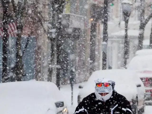
This week's "bomb cyclone," which culminated in a tornado that wrecked structures and injured people in Southern California, gave the Golden State another severe dose of winter weather.
While the South recovers from a band of tornadoes that struck the Mississippi Delta region, ravaging rural communities and killing more than two dozen people, more severe weather is predicted there.
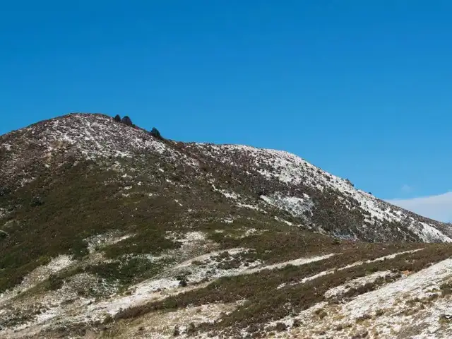
According to the meteorological service, the storm's addition will cause moderate to severe coastal rainfall as well as substantial snowfall in the state's northern coastal ranges and the southern part of the Cascade Mountains.
Mountainous areas may have wind gusts of up to 100 mph, which may create "hazardous blizzard conditions," according to AccuWeather. There may be wind gusts of between 50 and 60 miles per hour throughout the Bay Area.
The NWS stated that as the front starts to move south, "shower and thunderstorm chances will persist through Monday, focused mainly towards the Gulf Coast."
There is a minor chance of heavy rainfall for:
This week's "bomb cyclone," which culminated in a tornado that wrecked structures and injured people in Southern California, gave the Golden State another severe dose of winter weather.
While the South recovers from a band of tornadoes that struck the Mississippi Delta region, ravaging rural communities and killing more than two dozen people, more severe weather is predicted there.
California will see more severe rain and snow
According to AccuWeather, two storms will combine over the northern Pacific Ocean by Sunday night and hit the state by Monday night.According to the meteorological service, the storm's addition will cause moderate to severe coastal rainfall as well as substantial snowfall in the state's northern coastal ranges and the southern part of the Cascade Mountains.
Strong winds may cause power outages
Strong winds will once more be a possibility in Northern California, particularly in the Bay Area, leaving many citizens and companies without power. According to the Pacific Gas and Electric Company, the "bomb cyclone" last week had an impact on almost 610,000 of their customers.ADVERTISEMENT


Mountainous areas may have wind gusts of up to 100 mph, which may create "hazardous blizzard conditions," according to AccuWeather. There may be wind gusts of between 50 and 60 miles per hour throughout the Bay Area.
South-eastern storms
Until Monday, the Southeast might get showers and thunderstorms, and the NWS has increased the danger of flooding in certain areas.The NWS stated that as the front starts to move south, "shower and thunderstorm chances will persist through Monday, focused mainly towards the Gulf Coast."
ADVERTISEMENT
There is a minor chance of heavy rainfall for:
- Central Alabama
- Georgia
- East-central Louisiana
- Central Mississippi
- Alabama
FAQs:
- Where did it flood in California in 2023?
Pajaro and Watsonville - What was the worst storm in California's history?
December 1955: California flood
Download
The Economic Times Business News App for the Latest News in Business, Sensex, Stock Market Updates & More.
The Economic Times Business News App for the Latest News in Business, Sensex, Stock Market Updates & More.
Download
The Economic Times News App for Quarterly Results, Latest News in ITR, Business, Share Market, Live Sensex News & More.
The Economic Times News App for Quarterly Results, Latest News in ITR, Business, Share Market, Live Sensex News & More.
Related Articles
 Fresno tornado warning today: Funnel cloud seen in Clovis, tornado touchdown reported in California storm chaos
ADVERTISEMENT

