No powerful hurricane by August in US. What does this indicate?
The incident of non-development of any powerful hurricane by 15th August that could be named is rare, only occurred twice since 1960.
By ET Spotlight Special | Updated:

AP
The US is witnessing an unusual weather pattern. The occurrence of no powerful hurricanes by August. Since 1960 only two times have this happened. The dry, dusty air which avoided the coast of West Africa has kept the atmospheric water vapor from fueling the storm. Though at least one major hurricane develops by this time in August, Jeff Weber, atmospheric scientist at the National Centre for Atmospheric Research, "expect a robust hurricane season". Weather experts say climate change may be a factor in the late appearance of hurricanes this summer.
Weber explained how a persistent ridge of high pressure was responsible for driving last year’s forest fires in North America which he calls “blister on the planet”. According to him, this thing is now driving intense drought over Europe and Asia by sitting over the area. And that the factor for the delayed hurricane season is lack of moisture.
Weber further said that the ridge of high pressure is "diminishing the amount of water vapour" and that's a part of the reason why much tropical development is not being seen.
Though this unusual pattern is probably going to end because of growing weather activity in the Atlantic basin. He predicted that up to three major hurricanes and 10 to 14 storms will be fueled by warm sea surface temperature by November.
Currently, three storms named Danielle, Fiona, and Earl are developing on which NASA is keeping a close eye as they canceled the Artemis I lunch on Monday because of an engine temperature issue.
According to NASA, cautious guidelines will be kicked in in case of a hurricane to minimize weather-related risk with the 32-storey rocket stack ready to launch during this hurricane season in Florida.
Weber explained how a persistent ridge of high pressure was responsible for driving last year’s forest fires in North America which he calls “blister on the planet”. According to him, this thing is now driving intense drought over Europe and Asia by sitting over the area. And that the factor for the delayed hurricane season is lack of moisture.
Weber further said that the ridge of high pressure is "diminishing the amount of water vapour" and that's a part of the reason why much tropical development is not being seen.
Though this unusual pattern is probably going to end because of growing weather activity in the Atlantic basin. He predicted that up to three major hurricanes and 10 to 14 storms will be fueled by warm sea surface temperature by November.
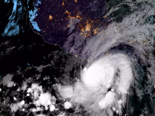
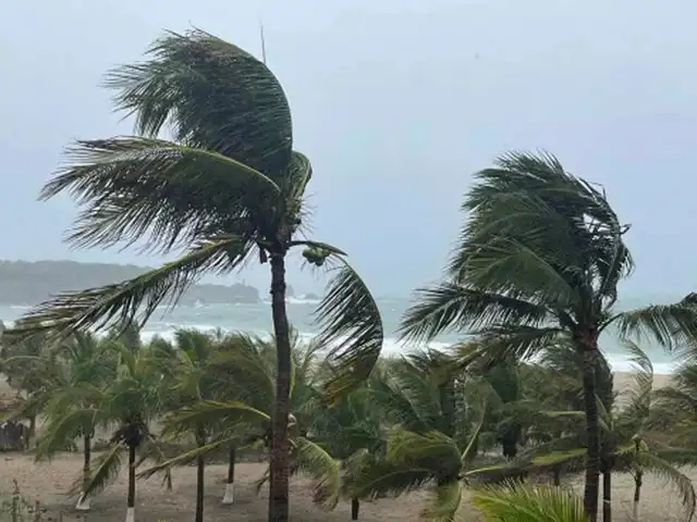
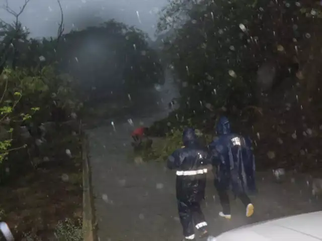
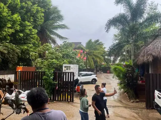
The strongest hurricane on record to make landfall in May in the eastern Pacific swept ashore on a stretch of tourist beaches and fishing towns in southern Mexico on Monday.


Hurricanes are coming soon
According to Bob Robichaud, a Canadian Hurricane Centre Meteorologist, a hurricane may come within a few days. Though the number of hurricanes may be reduced due to climate change, the few that'll develop will be very powerful as the Hurricane Dorian that 3 years ago hit Atlantic Canada.Currently, three storms named Danielle, Fiona, and Earl are developing on which NASA is keeping a close eye as they canceled the Artemis I lunch on Monday because of an engine temperature issue.
#OnThisDay 17 years ago, #HurricaneKatrina made its second landfall over southeastern Louisiana after hitting Hallandale Beach, Florida four days earlier. The storm led to over 1,800 fatalities and $125 billion dollars in damage. pic.twitter.com/LGnljCd3tc
— NOAA Satellites (@NOAASatellites) August 29, 2022
ADVERTISEMENT
In case a tropical storm or hurricane formation occurs off the coast of the Gulf or Florida, then NASA would get a forecast from the U.S. Space Force 45th Weather Squadron or the Spaceflight Meteorology Group that monitors the East Coast for any potential issue.According to NASA, cautious guidelines will be kicked in in case of a hurricane to minimize weather-related risk with the 32-storey rocket stack ready to launch during this hurricane season in Florida.
Download
The Economic Times Business News App for the Latest News in Business, Sensex, Stock Market Updates & More.
The Economic Times Business News App for the Latest News in Business, Sensex, Stock Market Updates & More.
Download
The Economic Times News App for Quarterly Results, Latest News in ITR, Business, Share Market, Live Sensex News & More.
The Economic Times News App for Quarterly Results, Latest News in ITR, Business, Share Market, Live Sensex News & More.
Related Articles
 Hurricanes end 20-year Stanley Cup wait with dominant victory over Golden Knights2026-06-15T03:21:10Z
- Seth Jarvis nets OT winner as Hurricanes rally to even series against Golden Knights in Stanley Cup Final2026-06-05T03:42:09Z
- Hurricanes shut out Canadiens 4-0 in Game 4, edge closer to Stanley Cup Final berth2026-05-28T03:58:41Z
ADVERTISEMENT

