Hurricane Ian tracker: Up-to-date maps, predictions, potential trajectories, warnings
Florida is about to be hit by strong hurricane 'Ian' that will bring tornadoes, catastrophic storm surges, and strong winds. There is a hurricane or tropical storm warning in effect for the Florida Peninsula area. A substantial portion of Florida'...
By ET Spotlight Special |
Agencies
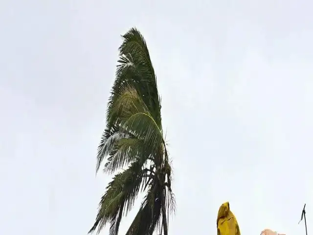
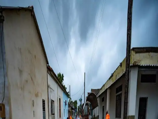
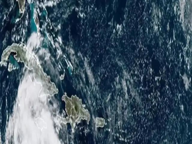
Powerful hurricane Ian is on its way to Florida, bringing severe winds, catastrophic storm surges, and even tornadoes. Hurricane Ian is now in the Gulf of Mexico and might make landfall on Florida's western coast between 1 and 6 p.m. on Wednesday (local time), somewhere between Port Charlotte and Sarasota. As it approached the shore, the storm was reaching Category 5 status. However, its trajectory, timing, and intensity might alter. Significant and deadly repercussions can happen far from the storm's core.
A hurricane or tropical storm warning for the Florida Peninsula region has been issued. Hurricane warnings are sent to Fort Myers and Tampa, and Chokoloskee towards the south.
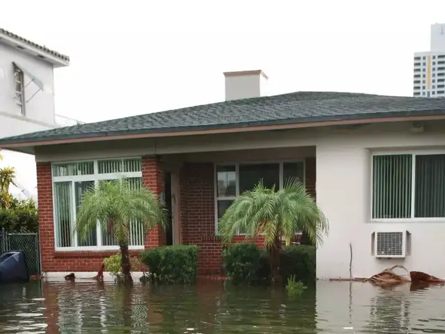
Tropical storm warnings have also been issued for Savannah and the surrounding area due to Hurricane Ian. If the hurricane moves north, tropical storm-force winds could hit coastal Georgia and South Carolina. Storm surges of up to 16 feet can be seen in Fort Myers, 10 feet in Sarasota, and 6 feet in Tampa. Storm surge warnings are in force for a significant part of Florida's west coast, from Cedar Key to the state's southwest tip.
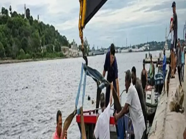
Flooding from heavy rainfall is also a possibility inland due to Hurricane Ian. The most rain is anticipated from Venice through Sarasota to the Tampa Bay region, where up to 20 inches of rain is forecasted. Tornadoes are probable when Ian makes landfall and travels north into Florida over the next three days. At least three have been reported in South Florida as of Tuesday night.
A hurricane or tropical storm warning for the Florida Peninsula region has been issued. Hurricane warnings are sent to Fort Myers and Tampa, and Chokoloskee towards the south.
Tropical storm warnings have also been issued for Savannah and the surrounding area due to Hurricane Ian. If the hurricane moves north, tropical storm-force winds could hit coastal Georgia and South Carolina. Storm surges of up to 16 feet can be seen in Fort Myers, 10 feet in Sarasota, and 6 feet in Tampa. Storm surge warnings are in force for a significant part of Florida's west coast, from Cedar Key to the state's southwest tip.


Flooding from heavy rainfall is also a possibility inland due to Hurricane Ian. The most rain is anticipated from Venice through Sarasota to the Tampa Bay region, where up to 20 inches of rain is forecasted. Tornadoes are probable when Ian makes landfall and travels north into Florida over the next three days. At least three have been reported in South Florida as of Tuesday night.
FAQ
- Hurricane Ian falls under which category?
Hurricane Ian has been upgraded to Category 5. - What is a tropical cyclone?
A tropical cyclone is a fast rotating storm system with a low-pressure core that causes torrential rain and squalls.
Download
The Economic Times Business News App for the Latest News in Business, Sensex, Stock Market Updates & More.
The Economic Times Business News App for the Latest News in Business, Sensex, Stock Market Updates & More.
Download
The Economic Times News App for Quarterly Results, Latest News in ITR, Business, Share Market, Live Sensex News & More.
The Economic Times News App for Quarterly Results, Latest News in ITR, Business, Share Market, Live Sensex News & More.
Related Articles
 Quote of the day by Ian Fleming: 'Never say 'no' to adventures. Always say 'yes,' otherwise you'll lead a very dull life' ; life lessons from James Bond's creator2026-05-11T19:49:43Z
- Sports-tech startup SportVot raises Rs 32.7 crore led by IAN Alpha Fund2026-04-29T00:30:00Z
- Quote of the Day by Ian Hacking: ‘The social risks that worry us are not random…’2026-04-27T04:03:16Z
ADVERTISEMENT

