Drones to help Rajasthan, Gujarat farmers detect crop diseases
Weather forecaster Skymet has already conducted a pilot project in parts of Gujarat to map the groundnut crop.
By Madhvi Sally, ET Bureau |

NEW DELHI:Farmers in Gujarat and Rajasthan could soon have an unmanned aerial vehicle flying over their fields to survey their crops, helping them map crop diseases along with assisting insurance companies in settling claims.
Weather forecaster Skymet has already conducted a pilot project in parts of Gujarat to map the groundnut crop along with Agriculture Insurance Company (AIC) of India and will soon be flying across field in the coming summer.
“Remote sensing through unmanned aerial vehicles allows nondestructive sampling to observe agronomic indicators every square metre. We did a pilot project last year and will increase its coverage across Rajasthan and Gujarat this year,” said Jatin Singh, CEO of Skymet.
The technology has been in use in the United States and other developed countries to map crop position, control farm subsidies, detect pests, monitor nutritional and water stress on crops, and even spray fertilizer and pesticides on crops.
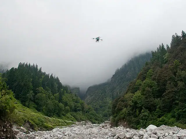
Skymet, along with the AIC and Gujarat government, used satellite remote sensing technologies and drones across 10 villages in Morbi district of Gujarat last year.
“We covered the groundnut crop, clicking images a few centimetres away, which is not possible via satellite,” said Singh. Satellite’s resolutions are less and if a cloud cover comes, then you can’t use the images, he said, adding, “At a time when land holdings are less and there is multicropping we were able to help Gujarat government in monitoring of the agriculture area and crop yield. The data could help AIC in giving farmers claims.”
The automatic and remote controlled UAVs cover 5 sq km in a single flight, with generally two flights (missions) per day. UAVs send images every five seconds and provide geo referenced images.
“It’s a beneficial technology for states that have digitised land records or are in the process of digitising. Pictures clicked by the unmanned aerial vehicles can be superimposed on digital maps of states and we can identify farms and crops sown,” said PJ Joseph, chairman and managing director of AIC.
Joseph said that with farmers not declaring the correct crop for insurance, the technology helped them find out total area under a particular crop sown. “UAVs are being used the world over. I feel that on a commercial basis the technology is cheaper than sending people in fields,” he said.
Skymet provides weather information to governments, companies, commodity markets, international organisations and banks.
In 2014, it raised $4.5 million from a consortium of investors led by Asia Pacific, an investment arm of the UK’s Daily Mail Group.
The company plans to use proceeds from the series B round of financing, in which Skymet’s existing investor, the Godrej group-backed Omnivore Partners also participated, to introduce new instrumentation for tracking hail and frost, research and development for weather forecasting, forecasting for crop area and yield, and to expand the market for its services.
Weather forecaster Skymet has already conducted a pilot project in parts of Gujarat to map the groundnut crop along with Agriculture Insurance Company (AIC) of India and will soon be flying across field in the coming summer.
“Remote sensing through unmanned aerial vehicles allows nondestructive sampling to observe agronomic indicators every square metre. We did a pilot project last year and will increase its coverage across Rajasthan and Gujarat this year,” said Jatin Singh, CEO of Skymet.
The technology has been in use in the United States and other developed countries to map crop position, control farm subsidies, detect pests, monitor nutritional and water stress on crops, and even spray fertilizer and pesticides on crops.
Skymet, along with the AIC and Gujarat government, used satellite remote sensing technologies and drones across 10 villages in Morbi district of Gujarat last year.
“We covered the groundnut crop, clicking images a few centimetres away, which is not possible via satellite,” said Singh. Satellite’s resolutions are less and if a cloud cover comes, then you can’t use the images, he said, adding, “At a time when land holdings are less and there is multicropping we were able to help Gujarat government in monitoring of the agriculture area and crop yield. The data could help AIC in giving farmers claims.”
ADVERTISEMENT
The automatic and remote controlled UAVs cover 5 sq km in a single flight, with generally two flights (missions) per day. UAVs send images every five seconds and provide geo referenced images.
“It’s a beneficial technology for states that have digitised land records or are in the process of digitising. Pictures clicked by the unmanned aerial vehicles can be superimposed on digital maps of states and we can identify farms and crops sown,” said PJ Joseph, chairman and managing director of AIC.
Joseph said that with farmers not declaring the correct crop for insurance, the technology helped them find out total area under a particular crop sown. “UAVs are being used the world over. I feel that on a commercial basis the technology is cheaper than sending people in fields,” he said.
Skymet provides weather information to governments, companies, commodity markets, international organisations and banks.
ADVERTISEMENT
In 2014, it raised $4.5 million from a consortium of investors led by Asia Pacific, an investment arm of the UK’s Daily Mail Group.
The company plans to use proceeds from the series B round of financing, in which Skymet’s existing investor, the Godrej group-backed Omnivore Partners also participated, to introduce new instrumentation for tracking hail and frost, research and development for weather forecasting, forecasting for crop area and yield, and to expand the market for its services.
Download
The Economic Times Business News App for the Latest News in Business, Sensex, Stock Market Updates & More.
The Economic Times Business News App for the Latest News in Business, Sensex, Stock Market Updates & More.
Download
The Economic Times News App for Quarterly Results, Latest News in ITR, Business, Share Market, Live Sensex News & More.
The Economic Times News App for Quarterly Results, Latest News in ITR, Business, Share Market, Live Sensex News & More.
Related Articles
 Nagrasu gurdwara crisis enters 4th day: Army deployed, drones monitoring; here's what's happening2026-06-23T08:57:53Z
- All eyes on China: From the deck of USS Portland, a new spy drone takes America’s maritime surveillance further into the South China Sea2026-06-23T04:02:07Z
- CISF gears up for cyber, drone threats as security risks evolve2026-06-22T18:06:29Z
Text: AP
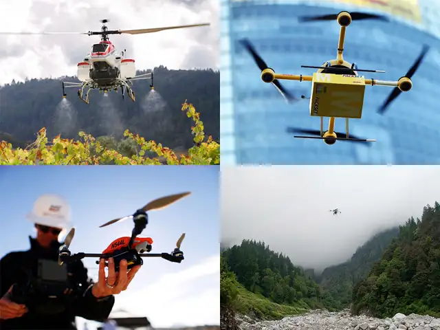
Most people think of drones as instruments of warfare, but as the Federal Aviation Administration slowly opens US airspace to commercial use of unmanned aircraft, they are going to become more commonplace.
The first uses are likely to be in remote, sparsely populated areas. Some of the proposed commercial applications for drones include:

ADVERTISEMENT

